Rysy: 2,499 or 2,501, and Why the Border Runs Through the Summit
I’ve watched a lot of people get this wrong on the trail up from Morskie Oko, and I got it wrong myself the first time, so I want to lay it out plainly before you plan a day around it. Rysy is Poland’s highest point. That’s true. It’s also not the whole truth, and the missing part changes what you’re actually looking at once you’re standing there, lungs burning, wondering which rock pile is the “real” summit.
The Number Everyone Quotes, and the One They Don’t
Every guidebook, every souvenir mug in Zakopane, every “top 10 facts about Poland” listicle says the same thing: Rysy, 2,499 m, highest point in the country. And it is — on the Polish side. The trouble is that Rysy isn’t one neat pyramid with a single tip. It’s a short, broken ridge with three rocky humps strung along it, and the international border between Poland and Slovakia runs directly across that ridge, more or less along its spine.
The northern hump, the one Polish trails lead to and the one with the plaque, benchmark and the crowd taking summit photos, tops out at 2,499 m. Walk a few dozen metres further south along the same crest, cross an invisible line with no fence and no sign beyond a small marker, and you’re in Slovakia, on the true high point of the massif: 2,501 m. Two metres. Two different countries. Same mountain.
Neither number is wrong. They’re answering two different questions. “What’s the highest point in Poland?” — 2,499 m, Rysy’s Polish summit. “What’s the highest point of the mountain called Rysy?” — 2,501 m, and it’s in Slovakia. Most sources only ever answer the first question, which is why the second one catches people by surprise when they finally read the trail sign at the top.
Standing on a Border I Couldn’t See
What struck me most, the day I finally did this hike from Morskie Oko, wasn’t the two metres of difference. It was how unremarkable the border itself looks. No barrier, no checkpoint, nothing like the crossings you picture on a map. Just rock, a bit more rock, and at some point you’ve technically left Poland without noticing the exact step. That’s the everyday reality of the Schengen border here — it runs through a national park, across a mountain ridge, and mostly exists on paper and on the marker stones rather than on the ground.
It also reframes what you’re photographing. The view from the Polish summit at 2,499 m is genuinely the best 360-degree panorama in the Polish Tatras — Czarny Staw and Morskie Oko laid out below you on one side, the High Tatras stacking up toward Slovakia on the other. You don’t need to touch the higher Slovak point to have “done” Rysy from Poland. But if you go expecting a single unambiguous highest spot and nothing higher anywhere nearby, the discovery that the actual apex is a short scramble away, in another country, is either a fun footnote or a mildly deflating surprise, depending on how much you’d built the number up in your head.
| Elevation | Country | Reached from | |
|---|---|---|---|
| Rysy — Polish summit | 2,499 m | Poland | Marked Polish trail, chains near the top |
| Rysy — true summit | 2,501 m | Slovakia | Continue along the ridge past the Polish marker |
| Morskie Oko (start point) | 1,395 m | Poland | Palenica Białczańska car park, on foot |
| Czarny Staw (en route) | 1,672 m | Poland | 50 minutes above Morskie Oko |
What the Climb Actually Asks of You
None of this two-metre trivia matters if you’re not fit for the day itself, so let’s be honest about what it takes. This is not an add-on to a lakeside stroll. From Morskie Oko — itself a 2 to 3 hour walk or carriage ride from the car park at Palenica Białczańska — Rysy is a further 4 to 5 hours up, and 3 to 4 hours back down, past Czarny Staw and up a increasingly rocky, exposed trail with sections of chains near the top. Counting the approach, most people are looking at 10 to 12 hours on their feet, round trip, with over 1,100 m of ascent above the lake alone.
I wouldn’t recommend it as a spontaneous add-on after a relaxed morning at Morskie Oko. It’s a mountain day in its own right, ideally started at first light, with a TPN park ticket bought in advance, proper boots, layers for a summit that’s routinely 15-20°C colder and windier than the valley, and a hard turnaround time if weather closes in. The chains near the top aren’t decorative — the exposure is real, and afternoon storms in July and August build fast over this exact ridge, the same pattern that has caught out hikers on nearby Giewont too.
When I’d Go, and When I Wouldn’t
Snow can sit on the upper sections into June, and the route is realistically only fully walkable, chain-clear and safe from about July through September. I wouldn’t attempt it outside that window without proper alpine experience and gear, and I wouldn’t attempt it at all without checking the TOPR mountain safety conditions and weather forecast the night before and the morning of.
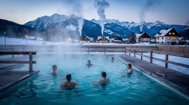
If that sounds like more commitment than your trip has room for, that’s a completely reasonable conclusion, and it’s not a lesser Tatras experience. Morskie Oko and Czarny Staw on their own, without pushing on to Rysy, are already one of the best day hikes in the range, and pairing that lake day with an evening soak is, frankly, how I’d choose to end it — a long approach on foot followed by an evening at Zakopane’s thermal baths does more for sore legs than anything else on offer locally.
If you’d rather have the whole Morskie Oko day organized for you, including transport from Kraków, a day trip to Morskie Oko and Zakopane handles the logistics so you can focus on the walk. And if the Tatras leg is really just one day of a longer Kraków base, a combined Zakopane and hot springs day tour is a gentler way to see the town and the mountains without committing to the full Rysy ascent.
For a longer stay built around this kind of hiking, I’d look at spreading the effort over several days rather than front-loading everything into one — see the 5-day hiking itinerary for how that can work, and check how many days first-timers actually need before committing to a single big-mountain day like this one.
Rysy: Common Questions Before You Climb
Is Rysy really the highest point in Poland?
Yes. The summit reached by Polish trails, at 2,499 m, is Poland’s highest point. The mountain’s actual highest summit, 2,501 m, is a short distance further along the same ridge but sits on the Slovak side of the border.
Why is the true summit of Rysy in Slovakia?
Rysy is a ridge with several rocky points rather than a single peak, and the Polish-Slovak border happens to run along that ridge. The Polish marked trail stops at the 2,499 m point, which is the highest ground still inside Poland; the ridge continues a little higher, to 2,501 m, on the Slovak side.
How hard is the hike to Rysy from Morskie Oko?
It’s a serious mountain day: roughly 4 to 5 hours up from Morskie Oko and 3 to 4 hours back down, with chains near the summit and real exposure. Combined with the walk in to Morskie Oko itself, most people are on the trail for 10 to 12 hours.
When can I climb Rysy without needing snow and ice gear?
Realistically from about July to September. Snow can linger on the upper trail into June, and the chained sections become genuinely dangerous with ice or fresh snow.
Do I need a ticket to hike to Rysy?
Yes, the same Tatra National Park entry ticket required for any trail in the park applies, bought online in advance or at the trailhead booth at Palenica Białczańska.
Can a fit beginner do Rysy as a first big hike?
I wouldn’t recommend it. The chains, exposure and length make this a route for experienced, fit hikers already comfortable with scrambling. First-timers are better served by Morskie Oko and Czarny Staw on their own, or the gentler Kasprowy Wierch cable car route for high-mountain views without the climb.
What’s the difference between Rysy and Czarny Staw?
Czarny Staw is a dark tarn about 50 minutes above Morskie Oko, at 1,672 m — a rewarding, much shorter walk with none of the exposure. Rysy rises above it and continues for several more hours to the 2,499 m summit; plenty of people stop at Czarny Staw and never continue.
Should I skip Rysy and do something else instead?
If the length and exposure don’t suit you, that’s a good call rather than a compromise — Morskie Oko itself, or an easier day like avoiding common Zakopane mistakes and checking summer thunderstorm patterns before any high-mountain day, will serve most visitors better than pushing for a summit that demands real experience.
tours.Explainer
Verified deep-linked GetYourGuide tours. Book through these links and we earn a small commission at no cost to you.
GetYourGuide does not provide a product photo for this activity — the image shows the meeting point, photographed by us.