Lomnický Štít Cable Car: Slovakia's Highest Point from Tatranská Lomnica
What is the Lomnický štít cable car and how do I get to it from Zakopane?
It is the cable car from the Slovak resort village of Tatranská Lomnica up to Lomnický štít, at 2,634 m the highest point reachable by cable car anywhere near Zakopane. Tatranská Lomnica sits 30 to 60 km from Zakopane across an open Schengen border, reachable with just an ID card and, once in Slovakia, euros instead of złoty. Ticket prices, rotation frequency and ride duration are not covered here and should be confirmed on the operator's own site before you plan a day around them.
Poland’s Highest Lift Doesn’t Reach This High
Every cable car on the Polish side of the Tatras tops out below 2,000 m. The one at Kuźnice climbs to Kasprowy Wierch, 1,987 m, and that is as high as a lift takes you anywhere in Poland’s Tatra National Park — see the full mechanics of that ride in the Kasprowy Wierch cable car guide. Poland’s actual highest point, Rysy at 2,499 m, has no lift at all: it is a long day on foot from Morskie Oko, for fit and experienced walkers only.
Cross the border into Slovakia, though, and the ceiling lifts. From the resort village of Tatranská Lomnica, a cable car climbs to Lomnický štít, 2,634 m — the highest point reachable by cable car anywhere in this stretch of the Tatras, on either side of the frontier. It is higher than Rysy, higher than Kozi Wierch, and roughly 650 m above the top of the Kasprowy Wierch lift. For a reader based in Zakopane, it is the one summit in this whole guide’s territory that you can reach without a full day of hiking, chains, or a permit-controlled trailhead — provided the weather cooperates and the practicalities are checked in advance.
This page sets out where Lomnický štít sits among the peaks already familiar from the Polish side, how to get from Zakopane to Tatranská Lomnica, and what this guide deliberately does not tell you.
How High Is Lomnický Štít, Really
Numbers on their own are easy to misjudge on a map that spans two countries and two national parks. Set side by side against the peaks already covered in the Polish Tatra chapters of this site, the scale becomes clearer.
| Point | Elevation | Country | Reached by |
|---|---|---|---|
| Lomnický štít | 2,634 m | Slovakia | Cable car from Tatranská Lomnica |
| Rysy | 2,499 m | Poland (highest point) | On foot only, from Morskie Oko |
| Kozi Wierch | 2,291 m | Poland | On foot only |
| Kasprowy Wierch | 1,987 m | Poland | Cable car from Kuźnice |
| Giewont | 1,894 m | Poland | On foot, chains near the summit |
| Gubałówka | 1,126 m | Poland | Funicular from Krupówki |
Lomnický štít is not just taller than anything the Polish side offers by lift — it is taller than Rysy, the highest point Poland has at all, reachable only by a demanding hike from Morskie Oko. That gap is worth sitting with before you plan a day: a cable car ride on the Slovak side puts you higher, with less physical effort, than the hardest achievable target on the Polish side. It does not make the Slovak summit a stroll — exposure, weather and altitude still apply at 2,634 m — but it changes who can realistically reach it.
Crossing the Border: Zakopane to Tatranská Lomnica
Tatranská Lomnica lies roughly 30 to 60 km from Zakopane, depending on the route taken through the mountains and valleys that separate the two national parks. The border itself is open: Poland and Slovakia are both in the Schengen area, so there is no passport check, no customs stop, and no formal crossing procedure. An identity card or passport is enough to carry, even if nobody asks to see it.
What does change at the border is the currency. Poland uses the złoty (PLN), and Poland is not in the eurozone. Slovakia uses the euro. A day that starts with breakfast on Krupówki and ends at the base of the Lomnický štít cable car crosses a currency line as well as a national one — worth planning for with a card that works in both countries, or a small stash of each currency, rather than discovering it at a ticket window.
This is the same open-border logic that applies to every other Slovak destination covered from a Zakopane base: the comparison of Zakopane and the Slovak Tatras sets out the fuller picture of what changes and what doesn’t once you’re on the other side.
What This Guide Does Not Tell You
In the interest of not sending anyone to a trailhead, or in this case a cable car base station, on stale information, this page deliberately leaves out three things:
- Ticket price. Cable car pricing in the Tatras — on both sides of the border — moves between seasons and years, and this site does not carry a confirmed current figure for the Lomnický štít lift.
- Rotation frequency. How often the cars run, and whether departures are timed or first-come, is not stated here.
- Ride duration. The length of the journey up to the summit station is not given.
None of these are trivial details to skip on a page about a cable car — they usually sit at the centre of a guide like this one. They’re left out here because getting them wrong would be worse than not printing them at all: a number that was right last season and wrong this one sends a reader to the wrong queue at the wrong time. Check the operator’s own current information before building a day around a specific departure, especially in July and August when demand on every high-altitude Tatra lift, Polish or Slovak, runs highest.
Weather Rules the Mountain, Not the Schedule
The single most useful thing to carry into a day at Lomnický štít isn’t a ticket time, it’s the same caution that applies to every high cable car in this mountain range. On the Polish side, the Kasprowy Wierch cable car stops running in strong wind and closes for stretches in late autumn and part of spring — a fact worth knowing before counting on any ride to a Tatra summit as a sure thing, as the Kasprowy Wierch guide sets out in full. The same underlying physics apply on the Slovak side: an exposed cable car climbing above 2,600 m is not going to run through high wind, whichever country operates it.
Afternoon thunderstorms are frequent across the whole Tatra massif in July and August, building through the morning and breaking in early afternoon. This is well documented on the Polish side — it’s the pattern behind the fatal 2019 lightning strike on Giewont’s summit cross, covered in the Tatra mountain safety guide — and there is no reason to expect the Slovak High Tatras follow a different sky.
A summit at 2,634 m, connected by cable car or not, is not a place to be caught in a building storm. Planning an early start, keeping a weather eye on the day, and treating a cancelled or delayed ride as a real possibility rather than a remote one is the same discipline that applies to Kasprowy Wierch, transplanted across the border.
Pairing the Day: Štrbské Pleso or Bachledka
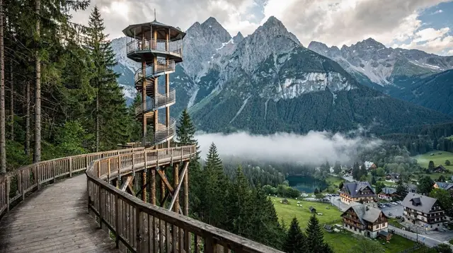
Tatranská Lomnica does not sit in isolation. It’s one stop among several along the same stretch of the Slovak High Tatras that also includes the glacial lake at Štrbské Pleso, 1,346 m up and frozen roughly 155 days of the year, and the treetop walk at Ždiar, the Bachledka walkway that runs step-free for over a kilometre with a spiral slide at its tower. Both make sense as a second stop on the same day as Lomnický štít, rather than treating all three as separate trips.
A single day realistically holds the cable car plus one of the two — Štrbské Pleso if the goal is a calmer lakeside walk after the altitude, or Bachledka if a family with children is along and wants something more active than a summit view. Trying to force the cable car, the lake, and the treetop walk into one day from a Zakopane base leaves little room for the weather delays that are common on any of the three, and turns a day meant to be memorable into a itinerary run on a stopwatch.
One organised option covers exactly this pairing in a single booked day:
a day trip from Zakopane that combines the treetop walk at Ždiar with the lake at Štrbské Pleso — useful groundwork for the region even on a day the cable car itself isn’t the focus, and a sensible way to see the neighbouring stops covered in the Bachledka treetop walk guide and the Štrbské Pleso guide without driving yourself.
Getting There Without Your Own Car
On the Polish side of this site’s coverage, minibuses handle almost every trailhead transfer and no rental car is assumed. The Slovak High Tatras work differently: this is a longer cross-border day, and while public transport connects Poprad, Tatranská Lomnica and the surrounding villages, this guide does not detail independent bus or train routing from Zakopane itself.
What is well covered instead is organised transport that removes the routing question entirely. A two-day option reaches further into the region, adding one of Slovakia’s best-known castles to the mix:
a two-day High Tatras itinerary that extends to Spiš CastleFor a narrower, more flexible day, a private transfer-based option covers the Poprad gateway and the historic town beyond it:
a private transfer and tour from Poprad toward the old town of LevočaAnd for travellers who want to build a Slovak side day around a different anchor entirely — a castle rather than a cable car — there is a full-day route westward:
a full-day trip from Zakopane to Orava Castle and the Demänovská ice caveEach of these removes the need to work out złoty-to-euro logistics, parking, or which road handles the crossing best on a given day — useful given how much of this page has been about what isn’t nailed down about the cable car’s own operating details.
Setting Expectations Before You Go
A day built around Lomnický štít is not the same kind of day as a walk up to Rusinowa Polana or a funicular ride to Gubałówka. It involves a border crossing that requires nothing more than an ID card, a currency switch from złoty to euro, and a summit nearly 650 m higher than anything reachable by lift on the Polish side. It also involves the same weather discipline that governs Kasprowy Wierch: wind can stop the cars, and July-August afternoons build storms that are not worth being caught in at 2,634 m.
What this page won’t do is promise a price, a departure time, or a ride length that might be wrong by the time you read it. That’s a deliberate gap, not an oversight — the kind of detail worth confirming directly with the operator on the day you’re planning to go, the same way anyone heading to Kasprowy Wierch on the Polish side should check current ticket availability before assuming a seat.
For the wider question of whether a Slovak-side day belongs in a Zakopane trip at all, and how it stacks up against staying on the Polish side of the border, the Zakopane versus Slovak Tatras comparison and the Slovak side 2-day itinerary both cover that decision in more depth. Readers planning a longer loop that takes in the Pieniny as well should also look at the Tatras and Pieniny 7-day itinerary, which threads Lomnický štít’s side of the border into a longer trip rather than a single day out.
Lomnický Štít Cable Car: Common Questions
Is Lomnický štít higher than anything on the Polish side?
Yes. Lomnický štít stands at 2,634 m, which is higher than Rysy (2,499 m on the Polish side, Poland’s highest point), higher than Kozi Wierch (2,291 m), and far higher than Kasprowy Wierch (1,987 m), the top of the highest cable car in the Polish Tatras. Unlike Rysy, which is reached only on foot, Lomnický štít is reached by lift.
Do I need a visa or border check to reach Tatranská Lomnica from Zakopane?
No. Poland and Slovakia are both in the Schengen area, so there is no border control on the crossing, which lies roughly 30 to 60 km from Zakopane depending on the route taken. An identity card or passport is enough to carry, even though nobody checks it at the border itself.
What currency do I need on the Slovak side?
Euros. Poland uses the złoty and is not in the eurozone, but Slovakia uses the euro, so a day that starts in Zakopane and ends at Tatranská Lomnica crosses a currency line as well as a border. Carrying a card that works in both countries, or a little cash in each currency, avoids the scramble.
Can the cable car close for weather?
The general rule across every high lift in the Tatras, Polish or Slovak, is that strong wind can stop the cars and afternoon thunderstorms are frequent in July and August. This is the same caution that applies to the Kasprowy Wierch cable car on the Polish side, and it is worth building a weather buffer into any plan that depends on reaching an exposed 2,634 m summit.
What ticket price, schedule or ride duration should I expect?
This guide does not state a price, a rotation frequency or a journey time for the Lomnický štít cable car, because those details change between seasons and are not part of the confirmed facts behind this site. Check the operator’s current information directly before building a day trip around a specific departure.
Should I combine Lomnický štít with Štrbské Pleso or the Bachledka treetop walk?
Both pair naturally with a day trip to Tatranská Lomnica, since Štrbské Pleso and the Bachledka treetop walk at Ždiar sit within the same stretch of the Slovak High Tatras. A single day from Zakopane can realistically take in the cable car and one of the two, rather than trying to force all three into one itinerary.
Is Tatranská Lomnica walkable without a car?
Tatranská Lomnica is a resort village built around tourism, and it is served by organised day trips from Zakopane that also take in Poprad, Štrbské Pleso or the treetop walk at Ždiar. A private car is not required to reach it, though independent public transport routing from Zakopane itself is not detailed here.
Slovak Tatras day trips
Verified deep-linked GetYourGuide tours. Book through these links and we earn a small commission at no cost to you.
GetYourGuide does not provide a product photo for this activity — the image shows the meeting point, photographed by us.