Two different mountain days, not one
Every summer, hikers arrive at Palenica Białczańska planning to “do the Five Lakes and Rysy” as a single big day, because both start from the same road and both sound like natural extensions of the walk to Morskie Oko. They are not the same trip, and treating them as one usually ends with someone descending in the dark.
The Valley of Five Polish Lakes (Dolina Pięciu Stawów Polskich) is a long but entirely chain-free walk: a wide, well-marked path past a waterfall and a chain of glacial tarns, doable by any hiker in reasonable fitness with a full day to spare. Rysy, at 2,499 m the highest point in Poland, is a different order of outing altogether — a steep, partly chained climb from Morskie Oko that stays under snow well into early summer and demands real scrambling near the top. The two trails share a starting road and, briefly, a junction, but they are not one hike with a bonus summit. This guide keeps them separate on purpose, because the Tatra Mountain safety record is full of people who blurred that line.
Getting to the start: Palenica Białczańska
Both routes begin at the same car park, Palenica Białczańska, about 25 km south-east of Zakopane on the road toward the Slovak border. No private vehicle goes any further: the car park here is the last point cars reach, and in season it must be reserved online in advance, days ahead in July and August. Most visitors without a car take one of the private minibuses that run from the centre of Zakopane and from Kościuszki street directly to Palenica — the ride takes 30 to 40 minutes and drops passengers a short walk from the barrier where the Tatra National Park (TPN) entry ticket is checked. That ticket, bought online at tpn.gov.pl or at the trailhead booth, is compulsory on every trail here, not only at the lake itself.
From the barrier, a wide paved road (closed to private traffic, open to service vehicles and horse carriages) runs toward Morskie Oko. The Five Lakes valley and Rysy share this same approach for the first stretch before splitting onto different paths — which is exactly where the confusion starts for hikers who have not decided in advance which of the two they are doing.
Route to the Five Lakes valley: distances and timing
The Five Lakes route leaves the paved Morskie Oko road at Wodogrzmoty Mickiewicza (“Mickiewicz’s Waterfalls”), a set of cascades roughly 5 km from Palenica, and climbs into the Roztoka valley. From there the path follows the stream up through spruce forest and then open, rocky terrain into the hanging valley that holds the five tarns.
| Segment | Distance | Typical time | Terrain |
|---|---|---|---|
| Palenica → Wodogrzmoty Mickiewicza | ~5 km | 1-1.5 h | paved road, flat |
| Wodogrzmoty → Siklawa waterfall | ~4 km | 1.5-2 h | forest path, steady climb |
| Siklawa → Valley of Five Lakes (Mały Staw) | ~1.5 km | 45 min | steeper switchbacks |
| Loop around the lakes | ~2-3 km | 1-1.5 h | rocky, open, no chains |
| Return to Palenica (same way) | ~10.5 km | 3-3.5 h | retrace, mostly downhill |
Total round trip: roughly 18-20 km and 9 to 11 hours, depending on how much time is spent at the lakes. There are no chains anywhere on this route — it is entirely a walking trail, though a long and tiring one, and the final approach involves real elevation gain on loose rock.
Wodogrzmoty Mickiewicza and the Roztoka valley
Wodogrzmoty Mickiewicza is worth the stop on its own: a series of cascades on the Roztoka stream named after the poet Adam Mickiewicz, framed by spruce forest, usually busy only in the first hour or two of the walk before the crowd thins toward the Five Lakes turn-off. Most day-trippers heading to Morskie Oko stay on the paved road past this point; the Five Lakes hikers peel off here, and the difference in foot traffic is immediate. Within twenty minutes of leaving the main road, the path empties out.
The Roztoka valley climb that follows is the main physical work of the day — a steady, sustained ascent through forest that gains most of the day’s elevation before the terrain opens up near Siklawa.
Siklawa: Poland’s highest waterfall
Siklawa, at the head of the Roztoka valley, drops about 70 m over a granite step and is generally cited as the highest waterfall in Poland. It marks the final climb into the Five Lakes basin: a set of switchbacks alongside the falling water that gains the last significant altitude of the route. In late spring, when snowmelt is heaviest, Siklawa runs at its fullest; by late summer it thins to a lighter curtain, still worth the stop and the best single photograph most hikers take on this route.
The five tarns
Above Siklawa the trail levels into the hanging valley that gives the route its name: five glacial lakes strung across a rocky basin below the ridge that separates Poland from the deeper Slovak side of the range. The largest, Wielki Staw Polski, sits furthest in; Mały Staw, the first reached, is where most hikers stop, eat, and turn around. A rough path loops partway around the basin for those with energy left, offering different angles on the lakes and the surrounding peaks, all without a single chain or exposed step.
The Pięciu Stawów hut (Schronisko przy Morskim Oku’s sister hut in the valley) sits at the edge of the basin and serves hot food and drinks to hikers who have earned them — a welcome stop before the long walk back down. This is also the junction point some hikers mistakenly treat as a gateway to Rysy: a connecting ridge trail does link this valley toward the Rysy approach, but it is a long, demanding traverse in its own right, not a shortcut, and it is not the route this page recommends combining with a Five Lakes day.
Why this valley stays quiet even in high season
The single biggest reason to choose the Five Lakes valley over Morskie Oko on a crowded July or August day is simple: the crowd thins out almost entirely once hikers leave the paved road at Wodogrzmoty Mickiewicza. Morskie Oko is reachable by horse carriage and by a flat paved path, so it draws visitors of every fitness level; the Five Lakes valley requires a genuine, sustained climb with no vehicle access at all, which filters out all but hikers prepared for a full day on foot. The lakes themselves, framed by bare rock and the high ridge toward Slovakia, feel remote in a way Morskie Oko — however beautiful — no longer does in peak season.
Rysy: a separate mountain, not a bonus summit
Rysy is climbed from a different trailhead entirely: from Morskie Oko itself, not from the Five Lakes valley. At 2,499 m on the Polish side, it is the highest point in Poland — though the mountain’s true highest summit, 2,501 m, sits just across the ridge in Slovakia. The climb from Morskie Oko gains roughly 1,100 m over about 4 km one way, on a path that turns into a genuine scramble in its upper third, with chains bolted into the rock across the steepest and most exposed sections below the summit ridge.
This is not a walk that shares character with the Five Lakes trail. It demands:
- a full, early-morning start — most hikers begin from Morskie Oko before or at dawn
- a realistic 11 to 13 hours round trip from the Morskie Oko car park area
- comfort with exposed scrambling and chained sections, not just steep walking
- good weather with no storm risk, since the upper ridge offers no shelter
- snow-free or near-snow-free conditions, which on this north-facing terrain often means not before early-to-mid July in an average year
Hikers who are not confident on chains, who are not in strong hiking condition, or who are short on daylight should treat Rysy as a trip for another visit — not as an add-on once the legs are already tired from the Five Lakes valley or the walk to Morskie Oko. For a detailed, step-by-step account of the ascent, see the dedicated guide to Czarny Staw and Rysy from Morskie Oko.
What the chains near the top actually involve
The chained sections on Rysy are not decorative safety rails; they run across slabs of polished, often wet limestone and granite where a slip has real consequences. Hikers should expect to use both hands, to queue behind slower parties in busy periods, and to descend the same chained ground they climbed — which for many people is the harder direction. This is meaningfully more exposed terrain than anything on the Five Lakes valley route, and closer in character to the chains near the summit of Giewont, though longer and at greater altitude. Anyone uneasy on Giewont’s short chained approach should not expect Rysy to feel easier.
When Rysy is actually in condition
Because Rysy’s upper slopes face north and hold snow long after the valleys have gone green, the mountain is often still dangerous with old, hard snow patches well after the Tatra hiking season has technically opened in mid-June. Most seasons, the route is not reliably snow-free until early-to-mid July, and conditions should always be checked locally — with TOPR, the Morskie Oko hut, or current trip reports — before setting out, rather than assumed from the calendar alone. Attempting Rysy on lingering snow without an ice axe and the experience to use one is one of the more common causes of rescue calls in the Polish Tatras each early summer.
Tatra National Park rules that apply on both routes
Both the Five Lakes valley and Rysy lie fully within Tatra National Park (TPN), and the same park rules apply on both:
- a TPN entry ticket is required on the trail, not only at Morskie Oko itself
- hikers must stay on marked trails — no shortcuts across the tundra or scree
- no dogs, except on the small number of exempted paths elsewhere in the park
- no drones
- no wild camping or bivouac; the only overnight option is the mountain hut system
- some of the highest sections, including approaches like Rysy, are closed from around 1 November to mid-June for avalanche risk and to protect nesting birds and chamois
For the current ticket process and prices, see booking Morskie Oko, Kasprowy Wierch and TPN tickets.
Five Lakes valley vs Rysy, side by side
| Valley of Five Polish Lakes | Rysy | |
|---|---|---|
| Trailhead | Palenica Białczańska | Morskie Oko |
| Distance | ~18-20 km round trip | ~8 km round trip from Morskie Oko |
| Elevation gain | ~700 m | ~1,100 m from Morskie Oko |
| Chains | None | Yes, near the summit ridge |
| Typical time | 9-11 hours | 11-13 hours (from Morskie Oko) |
| Suitable for | Fit, regular hikers | Experienced, fit mountain walkers only |
| Reliable season | Mid-June to September | Usually not before early-to-mid July |
| Crowd level | Light after Wodogrzmoty Mickiewicza | Busy on the approach, then thins fast |
Safety and TOPR
TOPR, the volunteer Tatra mountain rescue service founded in 1909, covers both routes; its number is 985 or +48 601 100 300, and 112 works everywhere. Rescue, including by helicopter, is free of charge in Poland — but that does not make the terrain forgiving.
Weather on the open ridges above the Five Lakes valley and on Rysy’s upper slopes changes fast, and afternoon thunderstorms are common in July and August; the aim on both routes is to be off any exposed high ground well before early afternoon. For a full rundown of what can go wrong and how to plan around it, see Tatra mountain safety and TOPR and Zakopane’s summer thunderstorm pattern.
When to go
The Five Lakes valley opens as soon as the snow clears from its lower sections, usually by mid-June, and stays walkable through September with the best combination of stable weather and thinner crowds arriving from late August. Rysy needs more patience: even once the valley trails are green, its north-facing upper slopes can hold old snow into early July, and both routes share the park-wide closure of high trails from roughly 1 November to mid-June. Neither route should be attempted in that closed window, whatever the weather looks like from town. For the fuller seasonal picture, see the month-by-month Zakopane weather guide.
Where this fits in a longer Tatra trip
For visitors building a multi-day hiking plan, the 5-day Tatras hiking itinerary is built to give the Five Lakes valley and Rysy their own separate days rather than compressing them together, alongside time at Morskie Oko and the cable car up to Kasprowy Wierch.
Hikers with less time but who still want the range’s scale without planning their own route can join a guided outing such as a full-day guided trip into the Tatra Mountains, or a more general Tatra exploration day from Zakopane, which typically covers gentler ground than either route on this page but gives a useful first look at the terrain before attempting the Five Lakes valley independently.
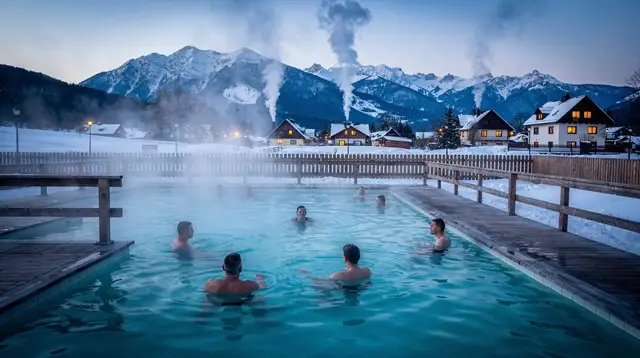
After a long day on either trail, the tired-legs cure most hikers reach for is one of the region’s thermal baths. A relaxed evening soak such as an entry ticket to thermal baths near Zakopane or Terma Bania’s thermal pools in Białka Tatrzańska is a genuinely practical way to recover before another day in the mountains, and both sit within easy reach of Zakopane town and the wider Podhale valleys.
Hikers planning to base themselves near the trailheads rather than in central Zakopane can also look at Kościelisko as an alternative valley base, or compare the Five Lakes route against the paved, family-friendly Kościeliska valley if the goal is a gentler day instead.
FAQ: hiking the Five Lakes valley and Rysy
Can I visit the Valley of Five Polish Lakes and climb Rysy on the same day?
No. The Five Lakes valley alone is a 9 to 11 hour round trip from Palenica Białczańska with no chains, and Rysy is a separate 11 to 13 hour round trip with chains, starting from Morskie Oko rather than from the Five Lakes valley. Combining both in one day is not realistic for almost any hiker and has contributed to rescue call-outs.
Are there chains on the Valley of Five Polish Lakes trail?
No. The entire route from Palenica Białczańska through Wodogrzmoty Mickiewicza, the Roztoka valley and Siklawa waterfall to the five tarns is a walking trail with no chained or exposed sections, though the final climb to the lakes is steep.
Is Rysy harder than the walk to Morskie Oko?
Considerably. The walk to Morskie Oko is a flat, paved path suitable for most fitness levels. Rysy is a steep mountain climb from Morskie Oko with about 1,100 m of ascent and chained, exposed sections near the summit ridge, suited only to fit, experienced hikers.
When is Rysy actually snow-free enough to climb safely?
Usually not before early-to-mid July in an average year, because its north-facing upper slopes hold old snow long after lower trails have cleared. Conditions should be checked locally before setting out, not assumed from the calendar.
Do I need a Tatra National Park ticket for both routes?
Yes. A TPN entry ticket is required on every marked trail in the park, including the full length of the Five Lakes valley route and the approach to Rysy from Morskie Oko, not only at the lake itself.
Why is Rysy considered Poland’s highest point if a higher summit exists nearby?
Rysy’s summit ridge straddles the Polish-Slovak border. The 2,499 m point on the Polish side is the highest point in Poland; the mountain’s true highest summit, 2,501 m, lies a short distance along the ridge on the Slovak side.
Is the Valley of Five Polish Lakes less crowded than Morskie Oko?
Yes, noticeably. Morskie Oko draws crowds of every fitness level because it is reached by a flat paved path and horse carriage. The Five Lakes valley requires a genuine climb with no vehicle access, which thins the crowd sharply once hikers leave the main road at Wodogrzmoty Mickiewicza.
What happens if the weather turns while I am on either trail?
Head down immediately, especially from any ridge or exposed section. Afternoon thunderstorms are common in July and August, and both routes have long, exposed sections above the treeline. TOPR can be reached at 985, +48 601 100 300, or 112, and mountain rescue in Poland is free of charge.